Lab 1
- haylee65
- Apr 15, 2021
- 1 min read

Overlaid map
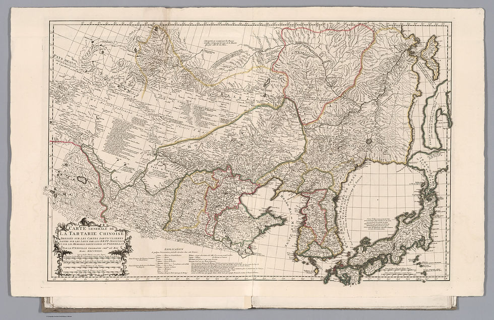
I picked this map because there was a clear distortion in longitude rather than latitude. I think the most interesting characteristic is Japan and how incorrect the island is. It is closer to Asia in the ancient map than it is in present time. I picked control points that clearly showed inconsistencies between the ancient and current Asia. The control points lined up along the east coast of Asia and points on Japan. There is a very large distortion in the northern part of the overlaid map, proving the thesis there is more distortion in longitude rather than latitude. There is pattern of map error, through Japan, like I mentioned previously.


Comments